Environmental Monitoring and Industrial Measurement
Environmental Monitoring and Industrial Measurement
Technical White Paper
Printer-Friendly Version
Unidata NEON satellite telemetry systems have integrated Globalstar, Inmarsat, Iridium, Thuraya, and Orbcom satellite systems. We have done modelling on the data latency and equally importantly, the costs of these services. We have also modelled the power consumption of these services. It is now clear to us that while these services are all satellite technology there are subtle aspects of each service which need to be considered when choosing an appropriate service for your needs. There are three distinct applications, where some service providers are more suitable than others.
If you have the need for what we call “alert” function, services such as Iridium short burst data, Inmarsat ISAT Data pro or Orbcom are probably best, especially Iridium and Inmarsat ISAT Data pro which are premium services, however, the data transmission costs escalate greatly for these services when the data rate is anything more than an occasional transmission of a short packet of data.
If you have the need for a traditional logging & reporting function, such as regular hydrographic or industrial measurement data from a measurement site, perhaps with the water level, flow and quality or some Modbus channels, services such as Globalstar and Inmarsat are probably best as the data transmission costs are more reasonable for larger volumes of data.
If you have a need for a low resolution or high resolution, image or perhaps a video capture capability, then Inmarsat would be the best as the bandwidth requirements are higher.
Satellite services are also used for only the most remote locations. Another important consideration for such very remote locations is power consumption. The ability to turn off the satellite modem most of the time to conserve power is critical. Some services allow for this easily, however, some services need to establish a “session” each time the modem is powered on, and the communications overhead in establishing a session are high, increasing the overall monthly cost to sometimes prohibitive levels.
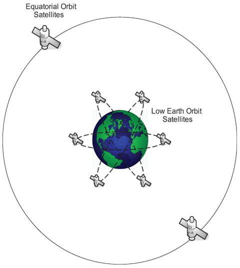
The physical location of the measurement station is another consideration, and there is a clear distinction between Low Earth Orbit Systems and Geostationary Systems. If a geostationary system is chosen, the satellite antenna must be located such that there is a clear view of the Geostationary Satellite’s location in the sky. Sometimes this is impossible, especially in deep valleys. If a Low Earth Orbit System is chosen, these systems transit the sky and satellite antennae, regardless off location, should be able to “see” a satellite most of the time.
Low earth Orbit systems are different, with Iridium providing the highest satellite numbers today, however, Iridium satellites are closer to end of design life now Globalstar has the smallest number of satellites today, however they have recently launched their second generation satellites so Globalstar is most likely be the leader for Low Earth Orbit Satellites.
The geographical location of your measurement station is another important consideration, for example, Iridium has coverage in the middle of the Pacific Ocean and in Antarctica, whereas Globalstar has coverage mainly over land areas. Inmarsat has worldwide coverage but you still need to ensure a good view towards the satellite. The antenna elevation in, say northeast Australia maybe 60 degrees elevation and very convenient, however in south-west Australia, the elevation may be only 40 degrees elevation and this may be less convenient.
Finally, it is always prudent to have a mix of services. In a flood alert system for example, perhaps it is best to have a mix of services from different providers and not put all your eggs in one basket. The telecommunications industry calls this network diversity.