Run-of-the-river hydroelectric generation is a method of generating electricity from flowing rivers without making water storage or large dams. Such plants are small and only divert a small amount of the river flow from the river for power generation, and then return that water flow back to the river a small distance downstream.
These smaller plants have less impact on the river, as they don’t need to have a large dam to store water. However there is a strong regulatory requirement to ensure the river parameters are not changed during the diversion. The water parameters need to be measured very carefully at the in-flow to the power station and at the out-flow of the power station before water is returned to the river.
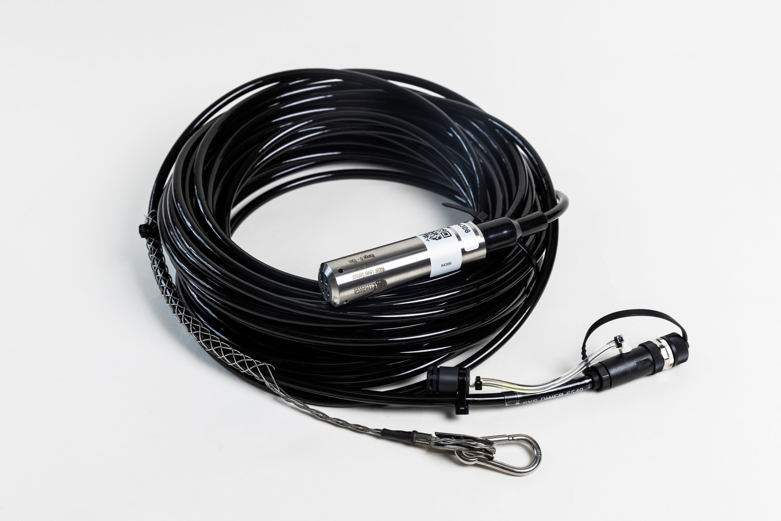
Water parameter measurement stations need to be installed at the intake and the outlet of the power station, and along the river at various points upstream and downstream from the power station. The measurements needed include water level, water flow, water quality/conductivity, and water temperature. With reliable data at these points, the operator can ensure they remain within the regulatory requirements of the state or provincial authority responsible for river management. As with all river parameter measurement, a measurement method needs to be determined. Smaller and easier probes to install such as hydrostatic pressure probes are generally preferred as the terrain conditions are often challenging. Using a large stilling well is often not practical, and also may not be allowed as these structures impact the environment. Stilling wells may be affected by seasonal flood conditions.
Typically, several instruments would be connected via one SDI-12 interface, as the application requires a very low power environment, and the slower speed of SDI-12 is acceptable for the application. Examples of instruments would be the 6527 Starflow QSD Ultrasonic Doppler Flow Meter, 6549A Water Level Sensor and temperature probes. The 6537 Starflow QSD SDI-12 Ultrasonic Doppler Instrument could be used to measure water depth, water velocity and conductivity/water quality. As these installations are often in rugged mountain environments, cell phone coverage is usually not available and satellite based telemetry systems are needed. The Satellite Neon Remote Logger, either low earth orbit or equatorial earth orbit systems could be chosen.
The terrain also needs to be considered. As these installations are usually in deep valleys, the view towards the sky is less, and the high hills may block the view to the equatorial earth orbit satellite provider of your choice. If you choose a low earth orbit system (these systems transit the sky every hour or so), coverage would be available for a short period of time when the low earth orbit satellite is visible from that location. A review of the local conditions, especially the view of the sky, is needed to determine the best choice. There are web based tools which provide the azimuth and elevation angles to different equatorial satellite providers based on the latitude and longitude of a particular location. With the azimuth and elevation angles, the site can be reviewed to determine if the use of an equatorial elevation satellite provider is practical.
As these systems are remote, primary power is generally not available so the solar panel and gel cell battery would be needed. Unidata engineers calculate a power budget, to determine size of the battery and solar panel needed for particular system. When calculating the power budget, geographical location and number of associated sunny days during the winter time are taken into account. This is to make sure the system is operational even with an extended period of cloudy days. Also, it is common practice to only power up the instruments when needed, for example, the instruments would be powered up, perhaps one minute before the reading time, and then turned off after the reading, to conserve power. The data collected at these measurement stations would be available to view on the Neon Server using a standard web browser, and anywhere on the web provided appropriate login credentials were set up on the Neon Server for this purpose.
Finally, we would expect for collected data to be passed on using Neon Server automatic reports, to a river monitoring / hydrographic analysis software package such as Aquarius or Hydstra for more detailed river hydrographic modelling and river gauging processes.